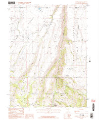
1986 Map of Jarbidge North
USGS Topo · Published 1987About this map
The Jarbidge River carves a deep path through this high-elevation landscape on the border of Nevada and Idaho, where the Humboldt National Forest meets the vast plateau of the Table Desert. This mid-1980s provisional survey shows a remote environment defined by its drainage systems, from Buck Creek to Columbet Creek, and several named geographic flats such as Columbet Table and Wilkins Island. Human activity is concentrated along the river corridor, where the Mahoney Ranger Station and a nearby cemetery stand as landmarks of local management and settlement history. High-desert logistics are evident in features like the Landing Strip and the evocatively named Freighters Defeat trail, while multiple prospects near Moore Gulch indicate the area's legacy of mineral exploration. The map provides a look at this borderland before modern developments, preserving the locations of isolated springs like Cottonwood Spring that were vital for range life.
Find a feature on this map
26 named features on this map. Tap any name to fly to it.
Don’t see what you’re looking for? This feature index may not catch every label — zoom into the map to look around manually.
Map Details
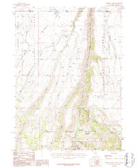
Editions of this 1986 Jarbidge North Map
2 editions found
Other maps of this area

1936 · Rowland
USGS Topo · 1:48,000

1940 · Rowland
USGS Topo · 1:62,500

1943 · Jarbidge
USGS Topo · 1:62,500

1945 · Jarbidge
USGS Topo · 1:62,500

1955 · Twin Falls
USGS Topo · 1:250,000

1955 · Wells
USGS Topo · 1:250,000

1958 · Wells
USGS Topo · 1:250,000

1958 · Twin Falls
USGS Topo · 1:250,000

1961 · Wells
USGS Topo · 1:250,000

1979 · Cowan Reservoir
USGS Topo · 1:24,000