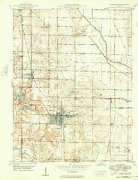
1940 Map of Jasonville
USGS Topo · Published 1949About this map
Jasonville serves as the central hub for this late-1940s survey, where the convergence of industrial extraction and public recreation defines the landscape. The intense presence of numerous Strip Mine operations surrounding the town reflects the era's coal economy, while to the west, the Shakamak State Park preserves a different character with Shakamak Lake and a Fish Hatchery. A relic of Indiana's earlier transportation history, the Wabash and Erie Canal, follows the Eel River valley, though its role has been superseded by the Chicago Milwaukee St Paul and Pacific railroad network. Rural life is anchored by local intersections and community landmarks such as Bogle Corner, Redruff Corner, and several country churches including Little Flock Ch and New Wilson Ch. This map provides an essential record for those tracing family ties in the coal-mining communities of Coalmont and Gilmour.
Find a feature on this map
47 named features on this map. Tap any name to fly to it.
Don’t see what you’re looking for? This feature index may not catch every label — zoom into the map to look around manually.
Map Details
Editions of this 1940 Jasonville Map
2 editions found
Other maps of this area

1908 · Clay City
USGS Topo · 1:48,000

1910 · Clay City
USGS Topo · 1:62,500

1938 · Coal City
USGS Topo · 1:24,000

1938 · Switz City
USGS Topo · 1:24,000

1940 · Lewis
USGS Topo · 1:24,000

1940 · Linton
USGS Topo · 1:24,000

1940 · Jasonville
USGS Topo · 1:24,000

1943 · Hymera
USGS Topo · 1:24,000

1943 · Dugger
USGS Topo · 1:24,000

1947 · Switz City
USGS Topo · 1:24,000