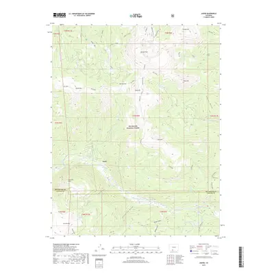
2019 Map of Jasper
USGS Topo · Published 2019About this map
The mountain settlement of Jasper occupies a high-altitude bend of the Alamosa River within the southern reach of the Rio Grande National Forest. This 2019 survey documents a landscape defined by dramatic elevation changes, from the alpine heights of Bennett Peak and Windy Mtn down to the drainage of California Gulch. Steep drainages like Rhodes Gulch and Scheier Gulch carve the terrain around Silver Mtn, illustrating the complex hydrology that feeds the Alamosa River. Local landmarks such as Cornwalls Nose and Alamosa Rock provide distinctive navigational points for those tracing the historical geography of Rio Grande and Conejos counties. High-country routes, including the Middle Frisco Cut-Off and the way through Blowout Pass, underscore the area's importance for transit across the Continental Divide foothills, while the presence of San Francisco Lakes and Cliff Lake highlights the glacial character of the upper basins.
Find a feature on this map
45 named features on this map. Tap any name to fly to it.
Don’t see what you’re looking for? This feature index may not catch every label — zoom into the map to look around manually.
Map Details
Editions of this 2019 Jasper Map
This is the sole edition of this map. No revisions or reprints were ever made.
Other maps of this area

1913 · Summitville
USGS Topo · 1:125,000

1914 · Creede
USGS Topo · 1:125,000

1915 · Summitville
USGS Topo · 1:125,000

1915 · Del Norte
USGS Topo · 1:125,000

1916 · Creede
USGS Topo · 1:125,000

1917 · Del Norte
USGS Topo · 1:125,000

1922 · Conejos
USGS Topo · 1:125,000

1945 · Durango
USGS Topo · 1:250,000

1953 · Durango
USGS Topo · 1:250,000

1954 · Durango
USGS Topo · 1:250,000