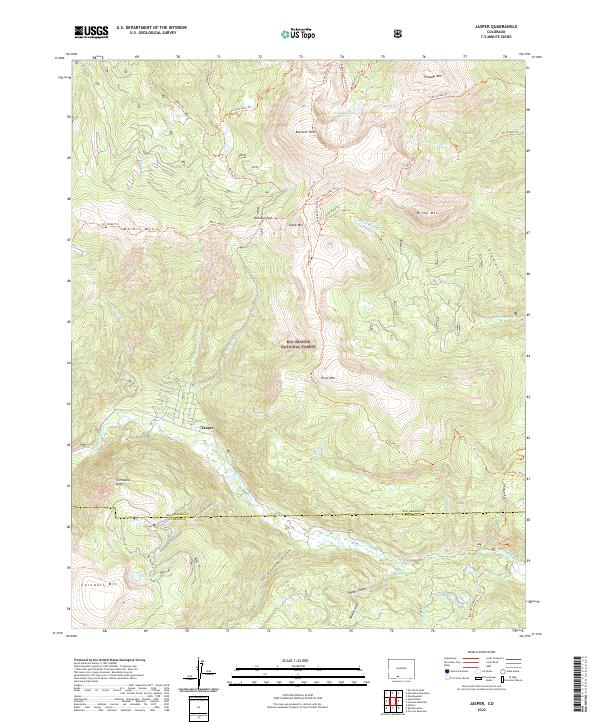
2022 Map of Jasper
USGS Topo · Published 2022About this map
The mountain settlement of Jasper serves as a central hub within this high-elevation section of the Rio Grande National Forest. The landscape is defined by the sharp transition between towering summits like Bennett Peak and Cornwall Mtn, and the deep drainage of the Alamosa River which flows across the southern portion of the quadrangle. A sophisticated network of trails, including the Big Lake (Shawcroft) Trl and the Silver Mtn Trl, suggests a history of access into the steep basins and gulches that surround the townsite. Significant hydrological features such as the San Francisco Lakes and Silver Falls illustrate the drainage patterns of this terrain. Historically, the named gulches like California Gulch and Castleman Gulch indicate areas of potential resource extraction or early homesteading efforts along the tributary streams feeding the main river valley.
Find a feature on this map
55 named features on this map. Tap any name to fly to it.
Don’t see what you’re looking for? This feature index may not catch every label — zoom into the map to look around manually.
Map Details
Editions of this 2022 Jasper Map
This is the sole edition of this map. No revisions or reprints were ever made.
Other maps of this area

1913 · Summitville
USGS Topo · 1:125,000

1914 · Creede
USGS Topo · 1:125,000

1915 · Summitville
USGS Topo · 1:125,000

1915 · Del Norte
USGS Topo · 1:125,000

1916 · Creede
USGS Topo · 1:125,000

1917 · Del Norte
USGS Topo · 1:125,000

1922 · Conejos
USGS Topo · 1:125,000

1945 · Durango
USGS Topo · 1:250,000

1953 · Durango
USGS Topo · 1:250,000

1954 · Durango
USGS Topo · 1:250,000