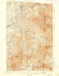
1925 Map of Jay Peak
USGS Topo · Published 1935About this map
Jay Peak and the high ridges of the Green Mountains dominate this 1920s-era landscape, where the northern border with Canada meets the rugged terrain of northern Vermont. The Missisquoi River valley serves as a vital corridor for both the Canadian Pacific and Central Vermont railroads, connecting international trade through the border town of Richford. In the southern portion of the map, the industrial footprint of the era is clearly visible at the Asbestos Mine on the slopes of Belvidere Mtn. Local life is recorded through an extensive network of schoolhouses, such as the Corey School and Woodward School, alongside small milling operations like Stevens Mill and Tillotson Mill. The presence of Hazens notch road underscores the historical transit routes through the gaps in the mountain range.
Find a feature on this map
90 named features on this map. Tap any name to fly to it.
Don’t see what you’re looking for? This feature index may not catch every label — zoom into the map to look around manually.
Map Details
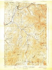
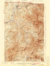
Editions of this 1925 Jay Peak Map
4 editions found
Other maps of this area

1919 · Montgomery
USGS Topo · 1:62,500

1920 · Franklin Pond
USGS Topo · 1:62,500

1920 · Montgomery
USGS Topo · 1:62,500

1920 · Irasburg
USGS Topo · 1:62,500

1922 · Enosburg Falls
USGS Topo · 1:48,000

1923 · Irasburg
USGS Topo · 1:48,000

1924 · Enosburg Falls
USGS Topo · 1:62,500

1925 · Irasburg
USGS Topo · 1:62,500

1925 · Jay Peak
USGS Topo · 1:62,500

1925 · Mount Mansfield
USGS Topo · 1:48,000