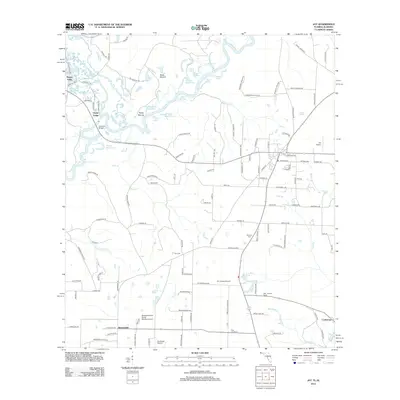
2012 Map of Jay
USGS Topo · Published 2012About this map
The Escambia River and Conecuh River dominate this landscape on the Florida-Alabama border, creating a complex network of wetlands and oxbow lakes. Numerous former river channels remain as distinct water bodies, including Jernigan Dead River, Government Dead Lake, and Ashton Dead River. This hydrology has long influenced the settlement patterns of the region, where small communities like Happy Valley and Oyster Lodge sit near the river's edge, while the town of Jay serves as a more developed hub on higher ground to the east.
Find a feature on this map
125 named features on this map. Tap any name to fly to it.
Don’t see what you’re looking for? This feature index may not catch every label — zoom into the map to look around manually.
Map Details
Editions of this 2012 Jay Map
This is the sole edition of this map. No revisions or reprints were ever made.
Other maps of this area

1941 · Century
USGS Topo · 1:62,500

1943 · Century
USGS Topo · 1:62,500

1943 · Jay
USGS Topo · 1:62,500

1953 · Andalusia
USGS Topo · 1:250,000

1957 · Andalusia
USGS Topo · 1:250,000

1957 · Pensacola
USGS Topo · 1:250,000

1959 · Pensacola
USGS Topo · 1:250,000

1959 · Brewton South
USGS Topo · 1:24,000

1960 · Pensacola
USGS Topo · 1:250,000

1960 · Brewton South
USGS Topo · 1:24,000