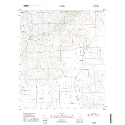
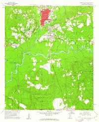
2018 Map of Jay
USGS Topo · Published 2018About this map
The Escambia River and its intricate network of side channels define the western border of this 2018 survey, where the river splits into numerous cutoffs and oxbows like Jernigan Dead River and Ashton Dead River. This complex riparian landscape is dotted with named basins including Government Dead Lake and Turtle Cove Lake, reflecting a dynamic waterway that has shaped local property and county lines for generations. To the east, the terrain rises into the agricultural and timber lands surrounding Jay, Florida, and the neighboring settlement of Flomaton just across the Alabama state line.
Find a feature on this map
135 named features on this map. Tap any name to fly to it.
Don’t see what you’re looking for? This feature index may not catch every label — zoom into the map to look around manually.
Map Details
Editions of this 2018 Jay Map
This is the sole edition of this map. No revisions or reprints were ever made.
Other maps of this area
1941 · Century
USGS Topo · 1:62,500
1943 · Century
USGS Topo · 1:62,500
1943 · Jay
USGS Topo · 1:62,500

1953 · Andalusia
USGS Topo · 1:250,000

1957 · Andalusia
USGS Topo · 1:250,000
1957 · Pensacola
USGS Topo · 1:250,000
1959 · Pensacola
USGS Topo · 1:250,000
1959 · Brewton South
USGS Topo · 1:24,000
1960 · Pensacola
USGS Topo · 1:250,000
1960 · Brewton South
USGS Topo · 1:24,000