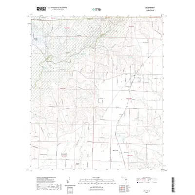
2021 Map of Jay
USGS Topo · Published 2021About this map
Big Escambia Creek and the Escambia River dominate this landscape along the border of Florida and Alabama, creating a complex wetland environment filled with oxbows and cutoffs like Ashton Dead River and Government Dead Lake. The map details the rural development near the towns of Jay and Century, where timber and agricultural roads such as Chumuckla Hwy and Ebenezer Church Rd lace through the bottomlands.
Find a feature on this map
132 named features on this map. Tap any name to fly to it.
Don’t see what you’re looking for? This feature index may not catch every label — zoom into the map to look around manually.
Map Details
Editions of this 2021 Jay Map
This is the sole edition of this map. No revisions or reprints were ever made.
Other maps of this area

1941 · Century
USGS Topo · 1:62,500

1943 · Century
USGS Topo · 1:62,500

1943 · Jay
USGS Topo · 1:62,500

1953 · Andalusia
USGS Topo · 1:250,000

1957 · Andalusia
USGS Topo · 1:250,000

1957 · Pensacola
USGS Topo · 1:250,000

1959 · Pensacola
USGS Topo · 1:250,000

1959 · Brewton South
USGS Topo · 1:24,000

1960 · Pensacola
USGS Topo · 1:250,000

1960 · Brewton South
USGS Topo · 1:24,000