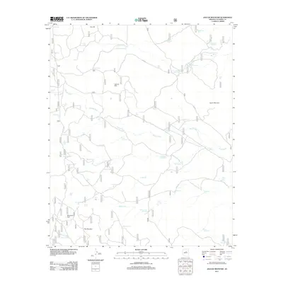
2011 Map of Jaycox Mountain
USGS Topo · Published 2011About this map
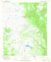
Jaycox Mountain and the surrounding high desert of Coconino County are defined here by a network of forest roads and essential water catchments. This 2011 survey illustrates a landscape managed for livestock and wildlife, where named tanks like Indian Ruin Tank, Hard Luck Tank, and Sin Agua Tank provide critical water sources in a region otherwise dominated by ephemeral drainage. The Sawmill Wash cuts through the center of the sheet, flanked by the Sawmill Hills and leading toward the grassy opening of Bargaman Park. Remote landmarks such as Dove Spring and Grapevine Spring offer a look at the natural hydrology of the Coconino National Forest area, while the Forest Service road network, including FS RD 82 and FS RD 135, provides the primary access to these isolated northern Arizona highlands.
Find a feature on this map
59 named features on this map. Tap any name to fly to it.
Don’t see what you’re looking for? This feature index may not catch every label — zoom into the map to look around manually.
Map Details
Editions of this 2011 Jaycox Mountain Map
This is the sole edition of this map. No revisions or reprints were ever made.
Other maps of this area

1887 · Verde
USGS Topo · 1:250,000

1892 · Verde
USGS Topo · 1:250,000

1954 · Holbrook
USGS Topo · 1:250,000

1957 · Holbrook
USGS Topo · 1:250,000

1958 · Holbrook
USGS Topo · 1:250,000

1960 · Holbrook
USGS Topo · 1:250,000
1965 · Hutch Mtn.
USGS Topo · 1:24,000
1965 · Mormon Lake
USGS Topo · 1:24,000
1965 · Happy Jack
USGS Topo · 1:24,000
1970 · Kinnikinick Lake
USGS Topo · 1:24,000