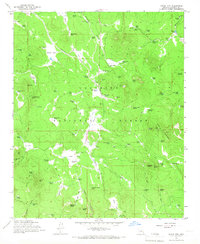
1965 Map of Hutch Mtn.
USGS Topo · Published 1967About this map
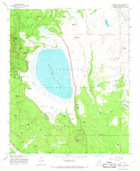
The Industrial Railroad cuts through the high timberlands of the Coconino National Forest, reflecting the mid-century industrial logging operations in this part of Arizona. The landscape is defined by a dense network of mountain parks and draws, including Bear Park, Tie Park, and Pratt Park, which served as natural clearings within the pine-covered terrain. Water management is a central theme of this 1960s survey, with numerous man-made livestock tanks and natural springs like Railroad Spring and Van Deren Spring scattered throughout the territory to support ranching operations at Coyote Basin Ranch and K-T Ranch. At the higher elevations, Hutch Mountain stands as a prominent landmark, hosting a Lookout and a Radio Facility, providing a clear view over the surrounding Fulton Canyon and the various pits, such as Borrow Pit No 1, that marked the era's infrastructure development.
Find a feature on this map
103 named features on this map. Tap any name to fly to it.
Don’t see what you’re looking for? This feature index may not catch every label — zoom into the map to look around manually.
Map Details
Editions of this 1965 Hutch Mtn. Map
4 editions found
Other maps of this area

1887 · Verde
USGS Topo · 1:250,000

1892 · Verde
USGS Topo · 1:250,000

1923 · Camp Verde
USGS Topo · 1:125,000

1932 · Camp Verde
USGS Topo · 1:125,000

1936 · Camp Verde
USGS Topo · 1:125,000

1954 · Holbrook
USGS Topo · 1:250,000

1957 · Holbrook
USGS Topo · 1:250,000

1958 · Holbrook
USGS Topo · 1:250,000

1960 · Holbrook
USGS Topo · 1:250,000
1965 · Mormon Lake
USGS Topo · 1:24,000