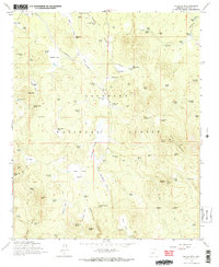
1965 Map of Hutch Mtn.
USGS Topo · Published 1972About this map
The Industrial Railroad cuts a path through the high timberlands of the Coconino National Forest in this 1965 survey, reflecting a landscape defined by ranching and logging operations. The map highlights the localized water infrastructure essential for livestock and industry, documented through numerous features like Clover Tank, Railroad Spring, and the Shipping Pasture Tank. Ranching history is anchored at the K-T Ranch and Coyote Basin Ranch, while the timber economy is evidenced by the railroad corridor and Sawmill Springs. High-elevation landmarks such as Hutch Mountain and Lookout Mountain dominate the eastern topography, with the former hosting a Radio Facility and fire lookout. To the south, specialized land uses appear at Pratt Park and Diversion Park, while the rugged relief is carved by Jacks Canyon and Kinnikinick Canyon. This survey captures the Forest Service's management of the area, from the Borrow Pit excavations to the network of interior roads like the Cabin Trail.
Find a feature on this map
106 named features on this map. Tap any name to fly to it.
Don’t see what you’re looking for? This feature index may not catch every label — zoom into the map to look around manually.
Map Details
Editions of this 1965 Hutch Mtn. Map
4 editions found
Other maps of this area

1887 · Verde
USGS Topo · 1:250,000

1892 · Verde
USGS Topo · 1:250,000

1923 · Camp Verde
USGS Topo · 1:125,000

1932 · Camp Verde
USGS Topo · 1:125,000

1936 · Camp Verde
USGS Topo · 1:125,000

1954 · Holbrook
USGS Topo · 1:250,000

1957 · Holbrook
USGS Topo · 1:250,000

1958 · Holbrook
USGS Topo · 1:250,000

1960 · Holbrook
USGS Topo · 1:250,000
1965 · Hutch Mtn.
USGS Topo · 1:24,000