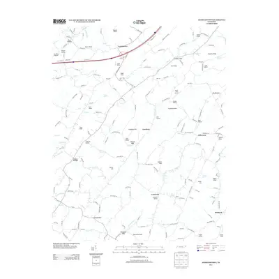
2013 Map of Jearoldstown
USGS Topo · Published 2013About this map
Jearoldstown serves as a central point in this part of Washington County, where the landscape is defined by a dense network of ridges, knobs, and narrow hollows. The presence of Clear Creek Mill and Eagle Mill points to a historical reliance on local waterpower along the many winding streams like Clear Creek and Jockey Creek. Small settlements and named communities are scattered throughout the terrain, including Union Temple, Centersville, and Mill Brook, reflecting a long-standing pattern of rural Appalachian settlement where families clustered near springs and sheltered valleys.
Find a feature on this map
172 named features on this map. Tap any name to fly to it.
Don’t see what you’re looking for? This feature index may not catch every label — zoom into the map to look around manually.
Map Details
Editions of this 2013 Jearoldstown Map
This is the sole edition of this map. No revisions or reprints were ever made.
Other maps of this area

1892 · Greeneville
USGS Topo · 1:125,000

1896 · Greeneville
USGS Topo · 1:125,000

1904 · Greeneville
USGS Topo · 1:125,000

1935 · Surgoinsville
USGS Topo · 1:48,000

1935 · Baileyton
USGS Topo · 1:24,000

1935 · Lovelace
USGS Topo · 1:24,000

1935 · Sullivan Gardens
USGS Topo · 1:24,000

1935 · Leesburg
USGS Topo · 1:24,000
1935 · Stonypoint
USGS Topo · 1:24,000

1935 · Fall Branch
USGS Topo · 1:48,000