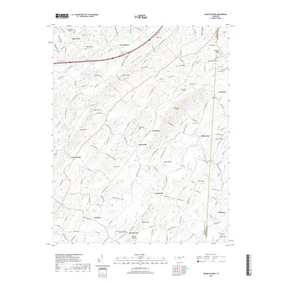
2019 Map of Jearoldstown
USGS Topo · Published 2019About this map
Jearoldstown and its surrounding communities are documented here as they transition through the early twenty-first century along the border of Greene and Washington counties. This rural landscape is defined by its deep ridges and valleys, with Bone Valley and Happy Valley providing the primary corridors for settlement and agriculture. The map reveals a dense network of local family history, anchored by several rural burying grounds including Providence Cem, Houston Cem, and the Pleasant Vale Cumberland Presbyterian Cem.
Find a feature on this map
169 named features on this map. Tap any name to fly to it.
Don’t see what you’re looking for? This feature index may not catch every label — zoom into the map to look around manually.
Map Details
Editions of this 2019 Jearoldstown Map
This is the sole edition of this map. No revisions or reprints were ever made.
Other maps of this area

1892 · Greeneville
USGS Topo · 1:125,000

1896 · Greeneville
USGS Topo · 1:125,000

1904 · Greeneville
USGS Topo · 1:125,000

1935 · Surgoinsville
USGS Topo · 1:48,000

1935 · Baileyton
USGS Topo · 1:24,000

1935 · Lovelace
USGS Topo · 1:24,000

1935 · Sullivan Gardens
USGS Topo · 1:24,000

1935 · Leesburg
USGS Topo · 1:24,000
1935 · Stonypoint
USGS Topo · 1:24,000

1935 · Fall Branch
USGS Topo · 1:48,000