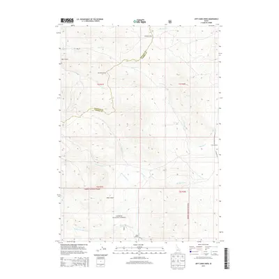
2013 Map of Jeff Cabin Creek
USGS Topo · Published 2013About this map
Caribou National Forest covers much of this high-elevation landscape along the boundary of Bannock and Caribou counties. The map is defined by the sharp topography of the Portneuf Range, where drainage systems like Ross Fork and Jeff Cabin Cr carve through the mountain terrain. Historically significant passage points like Bennetts Pass in the north and the deep incisions of Black Canyon and Bear Canyon reveal how geography dictated travel and land use in this corner of Idaho. Human activity is concentrated along few developed routes like Jeff Cabin Rd and near the Faulkner Ranch on the eastern edge. The complex hydrography, including the various forks of Little Toponce Cr and the presence of Warm Spring, indicates a landscape dominated by water rights and ranching boundaries in the early 21st century.
Find a feature on this map
24 named features on this map. Tap any name to fly to it.
Don’t see what you’re looking for? This feature index may not catch every label — zoom into the map to look around manually.
Map Details
Editions of this 2013 Jeff Cabin Creek Map
This is the sole edition of this map. No revisions or reprints were ever made.
Other maps of this area

1917 · Portneuf
USGS Topo · 1:62,500

1918 · Paradise Valley
USGS Topo · 1:62,500

1954 · Pocatello
USGS Topo · 1:250,000

1955 · Yandell Springs
USGS Topo · 1:62,500

1955 · Idaho Falls
USGS Topo · 1:250,000

1955 · Driggs
USGS Topo · 1:250,000

1955 · Preston
USGS Topo · 1:250,000

1958 · Driggs
USGS Topo · 1:250,000

1958 · Idaho Falls
USGS Topo · 1:250,000

1958 · Pocatello
USGS Topo · 1:250,000