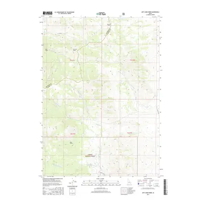
2017 Map of Jeff Cabin Creek
USGS Topo · Published 2017About this map
The Portneuf Range anchors this high-elevation landscape in eastern Idaho, where the ridgelines divide the drainage of the Ross Fork and Jeff Cabin Cr. This modern survey documents the interface between the Caribou National Forest and the surrounding high-desert terrain of the Bannock and Caribou county line. Significant hydrological features like Big Spring and Warm Spring point to the underground water systems that feed the numerous mountain creeks, including Little Toponce Cr and Fourth of July Cr. For researchers, the map details the rugged access routes into the backcountry, such as Jeff Cabin Rd and Toponce Canyon Rd, which lead to prominent topographical landmarks like Bennetts Pass, Bear Canyon, and Black Canyon.
Find a feature on this map
24 named features on this map. Tap any name to fly to it.
Don’t see what you’re looking for? This feature index may not catch every label — zoom into the map to look around manually.
Map Details
Editions of this 2017 Jeff Cabin Creek Map
This is the sole edition of this map. No revisions or reprints were ever made.
Other maps of this area

1917 · Portneuf
USGS Topo · 1:62,500

1918 · Paradise Valley
USGS Topo · 1:62,500

1954 · Pocatello
USGS Topo · 1:250,000

1955 · Yandell Springs
USGS Topo · 1:62,500

1955 · Idaho Falls
USGS Topo · 1:250,000

1955 · Driggs
USGS Topo · 1:250,000

1955 · Preston
USGS Topo · 1:250,000

1958 · Driggs
USGS Topo · 1:250,000

1958 · Idaho Falls
USGS Topo · 1:250,000

1958 · Pocatello
USGS Topo · 1:250,000