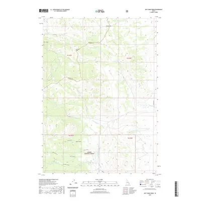
2020 Map of Jeff Cabin Creek
USGS Topo · Published 2020About this map
Caribou National Forest covers much of this high-elevation landscape along the boundary between Bannock and Caribou counties. The Portneuf Range serves as the dominant landform, where numerous drainages like Jeff Cabin Cr and Ross Fork carve through the mountain slopes. This 2020 survey illustrates a complex network of canyons and peaks, including the notable Bear Canyon and the dual-labeled Black Canyon in the southern reaches. Remote access is facilitated by the Jeff Cabin Rd, which climbs toward Bennetts Pass in the north. The area is defined by its intricate hydrology, featuring the headwaters of the Little Toponce Cr, Fourth of July Cr, and several forks of the Toponce Cr. Small landmarks such as Big Spring and Warm Spring indicate specific points of interest in this high-country terrain.
Find a feature on this map
25 named features on this map. Tap any name to fly to it.
Don’t see what you’re looking for? This feature index may not catch every label — zoom into the map to look around manually.
Map Details
Editions of this 2020 Jeff Cabin Creek Map
This is the sole edition of this map. No revisions or reprints were ever made.
Other maps of this area

1917 · Portneuf
USGS Topo · 1:62,500

1918 · Paradise Valley
USGS Topo · 1:62,500

1954 · Pocatello
USGS Topo · 1:250,000

1955 · Yandell Springs
USGS Topo · 1:62,500

1955 · Idaho Falls
USGS Topo · 1:250,000

1955 · Driggs
USGS Topo · 1:250,000

1955 · Preston
USGS Topo · 1:250,000

1958 · Driggs
USGS Topo · 1:250,000

1958 · Idaho Falls
USGS Topo · 1:250,000

1958 · Pocatello
USGS Topo · 1:250,000