
1968 Map of Jefferson
USGS Topo · Published 1971About this map
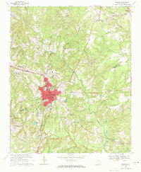
Lynches River winds through this landscape on the border of Chesterfield and Lancaster Counties, shaping a terrain defined by many small tributaries and rural communities. In the late 1960s, the town of Jefferson served as the primary hub, featuring the Jefferson Sch and Jefferson Cem. The surrounding countryside is dotted with small family and community anchors, including Miller-Lowery Cem and churches like Hopewell Ch and New Testament Ch.
Find a feature on this map
56 named features on this map. Tap any name to fly to it.
Don’t see what you’re looking for? This feature index may not catch every label — zoom into the map to look around manually.
Map Details
Editions of this 1968 Jefferson Map
This is the sole edition of this map. No revisions or reprints were ever made.
Other maps of this area

1941 · Spartanburg
USGS Topo · 1:250,000

1953 · Spartanburg
USGS Topo · 1:250,000

1960 · Spartanburg
USGS Topo · 1:250,000

1963 · Spartanburg
USGS Topo · 1:250,000

1964 · Spartanburg
USGS Topo · 1:250,000

1967 · Angelus
USGS Topo · 1:24,000

1967 · Mount Pisgah
USGS Topo · 1:24,000

1968 · Jefferson NE
USGS Topo · 1:24,000
1969 · Kershaw
USGS Topo · 1:24,000
1969 · Taxahaw
USGS Topo · 1:24,000