
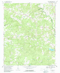
1967 Map of Mount Pisgah
USGS Topo · Published 1970About this map
Lynches River forms a natural boundary between Kershaw and Chesterfield counties in this mid-century landscape, which is defined by a dense network of rural churches and creek-side industry. The settlement at Mt Pisgah and nearby Midway Crossroads anchor a region where spiritual and community life is clearly mapped through numerous congregations, including Mt Pisgah Ch, Buffalo Ch, and Sandy Grove Ch. Local genealogy is further enriched by the inclusion of Stroud Cem and other burial sites.
Find a feature on this map
30 named features on this map. Tap any name to fly to it.
Don’t see what you’re looking for? This feature index may not catch every label — zoom into the map to look around manually.
Map Details
Editions of this 1967 Mount Pisgah Map
2 editions found
Other maps of this area

1935 · Camden
USGS Topo · 1:48,000

1938 · Camden
USGS Topo · 1:62,500

1941 · Spartanburg
USGS Topo · 1:250,000

1942 · Camden
USGS Topo · 1:125,000

1953 · Spartanburg
USGS Topo · 1:250,000

1960 · Spartanburg
USGS Topo · 1:250,000

1963 · Spartanburg
USGS Topo · 1:250,000

1964 · Spartanburg
USGS Topo · 1:250,000

1967 · Angelus
USGS Topo · 1:24,000

1968 · Jefferson
USGS Topo · 1:24,000