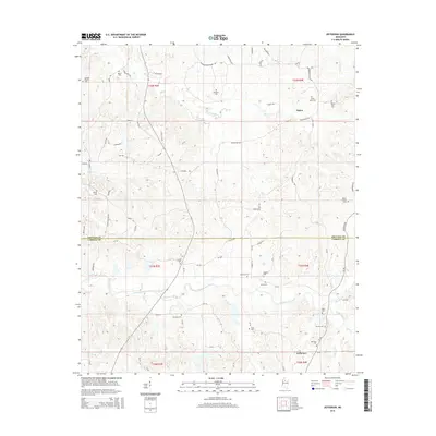
2015 Map of Jefferson
USGS Topo · Published 2015About this map
The boundary between Grenada and Carroll Counties bisects this rural landscape, which is defined by a dense network of country roads and family cemeteries. At the southern edge, the small settlement of Jefferson sits near Potacocowa Creek, while Nason occupies the higher ground to the north. The area is heavily intersected by small waterways, including Cane Cr and Loden Cr, which have shaped the local topography. This region is notably rich in historical burial sites, with over a dozen distinct grounds such as Franklin Cem, Jefferson Cem, and Mount Carmel Cem scattered across the township sections. These locations, combined with roads named for local families like Beard Rd and Denton Rd, provide a detailed framework for understanding the heritage and genealogical roots of these Mississippi hill country communities.
Find a feature on this map
88 named features on this map. Tap any name to fly to it.
Don’t see what you’re looking for? This feature index may not catch every label — zoom into the map to look around manually.
Map Details
Editions of this 2015 Jefferson Map
This is the sole edition of this map. No revisions or reprints were ever made.
Other maps of this area

1932 · Philipp
USGS Topo · 1:48,000

1935 · Philipp
USGS Topo · 1:62,500

1936 · Greenwood
USGS Topo · 1:62,500

1939 · Philipp
USGS Topo · 1:62,500

1940 · Greenwood
USGS Topo · 1:62,500

1953 · Greenwood
USGS Topo · 1:250,000

1953 · West Point
USGS Topo · 1:250,000

1954 · Grenada
USGS Topo · 1:62,500

1954 · McCarley
USGS Topo · 1:62,500

1956 · Greenwood
USGS Topo · 1:250,000