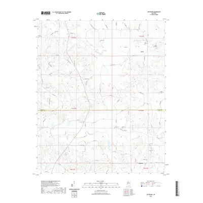
2020 Map of Jefferson
USGS Topo · Published 2020About this map
Jefferson and Nason anchor this interior Mississippi landscape as it appeared in the early 21st century. The map reveals a community defined by its proximity to the border of Grenada Co and Carroll Co, where the land is carved by the winding paths of Potacocowa Creek, Grays Creek, and Greasy Creek. This area is particularly rich in family and community burial sites, with over a dozen distinct locations documented, including the Jefferson Cem, Sweet Home Cem, and Mount Carmel Cem. The drainage patterns of small tributaries like Cane Cr, Dubard Br, and Mormon Br dictate the local road network, which transitions from named local streets such as Williams ST to county-maintained routes like Co RD 69 and Co RD 115. The layout of these crossings and the concentration of sites like Ebenezer Cem and Bledsoe Cem provide a clear view of the rural settlement patterns along the county line.
Find a feature on this map
86 named features on this map. Tap any name to fly to it.
Don’t see what you’re looking for? This feature index may not catch every label — zoom into the map to look around manually.
Map Details
Editions of this 2020 Jefferson Map
This is the sole edition of this map. No revisions or reprints were ever made.
Other maps of this area

1932 · Philipp
USGS Topo · 1:48,000

1935 · Philipp
USGS Topo · 1:62,500

1936 · Greenwood
USGS Topo · 1:62,500

1939 · Philipp
USGS Topo · 1:62,500

1940 · Greenwood
USGS Topo · 1:62,500

1953 · Greenwood
USGS Topo · 1:250,000

1953 · West Point
USGS Topo · 1:250,000

1954 · Grenada
USGS Topo · 1:62,500

1954 · McCarley
USGS Topo · 1:62,500

1956 · Greenwood
USGS Topo · 1:250,000