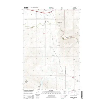
2014 Map of Jefferson Island
USGS Topo · Published 2014About this map
The confluence of the Boulder River and Jefferson River defines the landscape of this southwestern Montana corridor, where the settlements of Cardwell and Jefferson Island sit at the intersection of river life and mountain terrain. The map reveals an intricate network of water management, with numerous ditches like Parrot Ditch and Agricultural Ditch channeling water across the valley floor. Evidence of the region's ranching and transit history is found in family-named routes such as McKeown Ln and Armstrong Rd, while the southern reaches rise into the Deerlodge National Forest. Elevated landmarks including Cave Mtn and London Peak overlook the Summit Valley, providing a detailed picture of the physical boundaries that shaped local development from the river bottoms to the higher pastures of the London Hills.
Find a feature on this map
40 named features on this map. Tap any name to fly to it.
Don’t see what you’re looking for? This feature index may not catch every label — zoom into the map to look around manually.
Map Details
Editions of this 2014 Jefferson Island Map
This is the sole edition of this map. No revisions or reprints were ever made.
Other maps of this area

1888 · Three Forks
USGS Topo · 1:250,000

1893 · Dillon
USGS Topo · 1:250,000

1894 · Three Forks
USGS Topo · 1:250,000

1895 · Three Forks
USGS Topo · 1:250,000

1947 · Bozeman
USGS Topo · 1:250,000

1948 · Bozeman
USGS Topo · 1:250,000

1950 · Jefferson Island
USGS Topo · 1:62,500

1950 · Harrison
USGS Topo · 1:62,500

1955 · Bozeman
USGS Topo · 1:250,000

1955 · Dillon
USGS Topo · 1:250,000