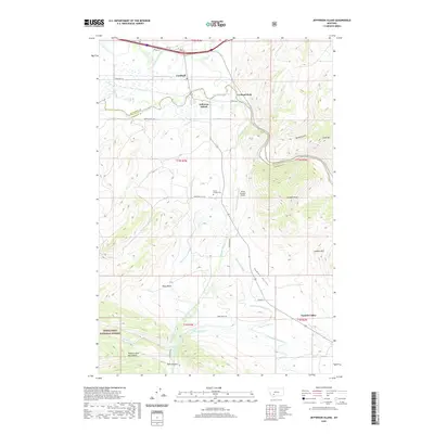
2020 Map of Jefferson Island
USGS Topo · Published 2020About this map
Cardwell and Jefferson Island anchor this landscape where the Jefferson River and Jefferson Slough navigate the valley floor. The map documents an intricate network of water management features essential to local agriculture, including the Agricultural Ditch, Three-Jim Ditch, and Dogtown Sewer. These systems weave through the lowlands between the London Hills to the east and the rising slopes of the Tobacco Root Mountains to the southwest.
Find a feature on this map
34 named features on this map. Tap any name to fly to it.
Don’t see what you’re looking for? This feature index may not catch every label — zoom into the map to look around manually.
Map Details
Editions of this 2020 Jefferson Island Map
This is the sole edition of this map. No revisions or reprints were ever made.
Other maps of this area

1888 · Three Forks
USGS Topo · 1:250,000

1893 · Dillon
USGS Topo · 1:250,000

1894 · Three Forks
USGS Topo · 1:250,000

1895 · Three Forks
USGS Topo · 1:250,000

1947 · Bozeman
USGS Topo · 1:250,000

1948 · Bozeman
USGS Topo · 1:250,000

1950 · Jefferson Island
USGS Topo · 1:62,500

1950 · Harrison
USGS Topo · 1:62,500

1955 · Bozeman
USGS Topo · 1:250,000

1955 · Dillon
USGS Topo · 1:250,000