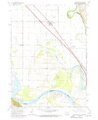
1963 Map of Jefferson
USGS Topo · Published 1971About this map
The Big Sioux River and the Missouri River converge at the tristate junction of South Dakota, Iowa, and Nebraska, defining a landscape of complex waterways and seasonal basins. This 1963 survey, updated in 1971, highlights the river-driven geography of Union County, South Dakota, where the Chicago Milwaukee St Paul and Pacific railroad and Interstate 29 run parallel through the town of Jefferson. The area is characterized by oxbow formations and remnants of former river channels, including Goodenough Lake, Mud Lake, and Mc Cook Lake, which illustrate the shifting nature of the Missouri floodplain.
Find a feature on this map
30 named features on this map. Tap any name to fly to it.
Don’t see what you’re looking for? This feature index may not catch every label — zoom into the map to look around manually.
Map Details
Editions of this 1963 Jefferson Map
4 editions found

Other maps of this area

1898 · Elk Point
USGS Topo · 1:125,000

1901 · Elk Point
USGS Topo · 1:125,000

1907 · Elk Point
USGS Topo · 1:125,000

1955 · Sioux City
USGS Topo · 1:250,000

1958 · Sioux City
USGS Topo · 1:250,000

1959 · Sioux City
USGS Topo · 1:250,000

1963 · Elk Point
USGS Topo · 1:24,000

1963 · Sioux City South
USGS Topo · 1:24,000

1963 · Sioux City North
USGS Topo · 1:24,000

1963 · Elk Point NE
USGS Topo · 1:24,000
Featured Places
- Dakota Dunes, SD
- North Sioux City, SD
- Jefferson, SD
- St. Johns Precinct, NE
- McCook Lake, North Sioux City