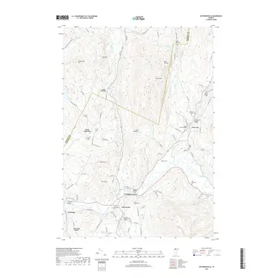
2018 Map of Jeffersonville
USGS Topo · Published 2018About this map
The Lamoille River and its tributaries define the landscape of this northern Vermont corridor, where the settlements of Jeffersonville and Cambridge Junction sit at the confluence with the Brewster River. The area is notable for its high concentration of historic river crossings, including the Grist Mill Covered Bridge and Poland Covered Bridge. These structures, along with the Gates Farm Covered Bridge to the west, illustrate the late-19th and early-20th-century transportation network that linked these small dairy and mill communities.
Find a feature on this map
91 named features on this map. Tap any name to fly to it.
Don’t see what you’re looking for? This feature index may not catch every label — zoom into the map to look around manually.
Map Details
Editions of this 2018 Jeffersonville Map
This is the sole edition of this map. No revisions or reprints were ever made.
Other maps of this area

1919 · Montgomery
USGS Topo · 1:62,500

1920 · Franklin Pond
USGS Topo · 1:62,500

1920 · Montgomery
USGS Topo · 1:62,500

1922 · Enosburg Falls
USGS Topo · 1:48,000

1924 · Enosburg Falls
USGS Topo · 1:62,500

1925 · Jay Peak
USGS Topo · 1:62,500

1925 · Mount Mansfield
USGS Topo · 1:48,000

1927 · Mount Mansfield
USGS Topo · 1:62,500

1927 · Hyde Park
USGS Topo · 1:48,000

1930 · Hyde Park
USGS Topo · 1:62,500