2024 Map of Jeffersonville
USGS Topo · Published 2024About this map
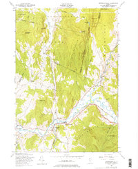
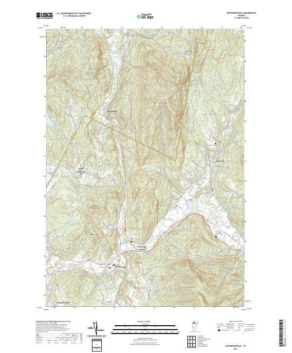
Jeffersonville sits at the confluence of the Brewster River and the Lamoille River, serving as a central hub for this portion of the Green Mountains. The landscape is defined by its deep river valleys and prominent peaks such as Fletcher Mtn and Ryan Mtn. Settlement patterns follow the winding course of the water, with Cambridge Junction and Waterville positioned along the North Branch Lamoille River. The area is notably dense with small family and community burial sites, including the Page Burial Plot and the Smiley Cem, which provide significant points of interest for genealogical research in this part of Lamoille County. Moving north, the terrain rises toward Bears Den Hill, while the western edge of the quadrangle is marked by North Cambridge and the Seymour River drainage. Modern trail systems like the 15 Trl and 108 Trl follow historical corridors, tracing the same paths that once connected these Vermont mountain communities.
Find a feature on this map
91 named features on this map. Tap any name to fly to it.
Don’t see what you’re looking for? This feature index may not catch every label — zoom into the map to look around manually.
Map Details
Editions of this 2024 Jeffersonville Map
This is the sole edition of this map. No revisions or reprints were ever made.