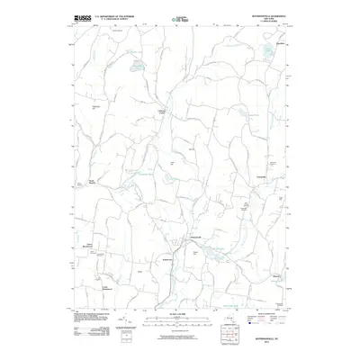
2010 Map of Jeffersonville
USGS Topo · Published 2010About this map
Jeffersonville serves as a central hub for this corner of Sullivan County, situated where North Branch Callicoon Creek and East Branch Callicoon Creek converge. The landscape is defined by its many small settlements and hamlets, including Youngsville, Kohlertown, and Callicoon Center, each connected by a network of rural roads that follow the winding valley floors. This area is notably dense with family and community burial grounds, such as Layton Cemetery, Bauerfeind Cemetery, and Dorrer Cemetery, which offer significant value for genealogists tracing early regional families. High points like Swiss Hill and Mandrake Hill overlook a geography punctuated by upland ponds and lakes, including Anawanda Lake and Petrillo Lake. In the northern reaches, Skytop Airport indicates the continued utility of the plateau terrain, while settlements like Upper Beechwood and Lower Beechwood highlight the distributed nature of historical hilltop and valley habitation.
Find a feature on this map
120 named features on this map. Tap any name to fly to it.
Don’t see what you’re looking for? This feature index may not catch every label — zoom into the map to look around manually.
Map Details
Editions of this 2010 Jeffersonville Map
This is the sole edition of this map. No revisions or reprints were ever made.
Other maps of this area

1920 · Long Eddy
USGS Topo · 1:62,500

1920 · Damascus
USGS Topo · 1:62,500

1921 · Long Eddy
USGS Topo · 1:48,000

1921 · Livingston Manor
USGS Topo · 1:62,500

1922 · White Lake
USGS Topo · 1:62,500

1923 · Damascus
USGS Topo · 1:62,500

1923 · Long Eddy
USGS Topo · 1:62,500

1923 · Livingston Manor
USGS Topo · 1:62,500

1942 · White Lake
USGS Topo · 1:62,500

1943 · Honesdale
USGS Topo · 1:125,000