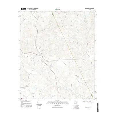
2017 Map of Jeffersonville
USGS Topo · Published 2017About this map
Jeffersonville serves as the central hub of this landscape where Twiggs and Wilkinson counties meet. The town's grid is oriented around the rail corridor, with S Railroad St and E Railroad St flanking the tracks. This proximity of transportation and local commerce is reinforced by the presence of numerous family burial grounds and community landmarks, including Jeffersonville Cem and the Wimberly Cem.
Find a feature on this map
69 named features on this map. Tap any name to fly to it.
Don’t see what you’re looking for? This feature index may not catch every label — zoom into the map to look around manually.
Map Details
Editions of this 2017 Jeffersonville Map
This is the sole edition of this map. No revisions or reprints were ever made.
Other maps of this area

1916 · Irwinton
USGS Topo · 1:62,500

1920 · Irwinton
USGS Topo · 1:62,500

1956 · Gordon
USGS Topo · 1:62,500

1956 · Jeffersonville
USGS Topo · 1:62,500

1957 · Macon
USGS Topo · 1:250,000

1958 · Macon
USGS Topo · 1:250,000

1964 · Macon
USGS Topo · 1:250,000

1973 · Massey Hill
USGS Topo · 1:24,000
1973 · Irwinton
USGS Topo · 1:24,000

1973 · Tarversville
USGS Topo · 1:24,000