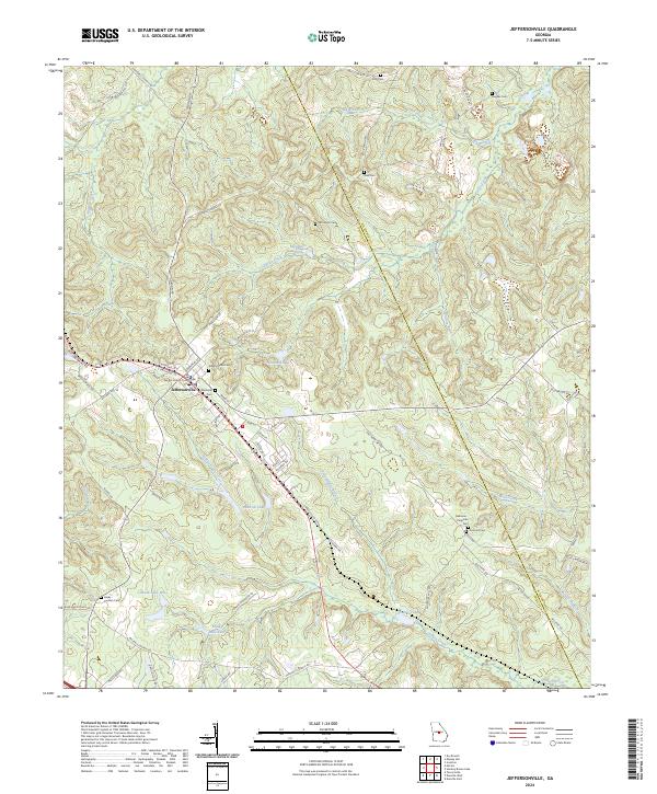
2024 Map of Jeffersonville
USGS Topo · Published 2024About this map
Jeffersonville serves as the central hub of this Georgia landscape, anchored by the Twiggs County Courthouse and a dense network of local streets. The town's historic footprint is evident in its many family-named cemeteries, including Jeffersonville Cem, Wimberly Cem, and McCollum Cem. The surrounding terrain is defined by a dendritic network of waterways such as Alligator Creek, Turkey Creek, and Pennywinkle Branch that wind through the hills of the Twiggs and Wilkinson county line. Large water bodies like Worsham Lake, Faulk Lake West, and Faulk Lake East dot the southern and central portions of the quadrangle. The map details an extensive road system, with rural routes like Gallimore Mill Rd and Durham Mill Rd suggesting a long-standing agricultural and milling history in the region.
Find a feature on this map
72 named features on this map. Tap any name to fly to it.
Don’t see what you’re looking for? This feature index may not catch every label — zoom into the map to look around manually.
Map Details
Editions of this 2024 Jeffersonville Map
This is the sole edition of this map. No revisions or reprints were ever made.
Other maps of this area

1916 · Irwinton
USGS Topo · 1:62,500

1920 · Irwinton
USGS Topo · 1:62,500

1956 · Gordon
USGS Topo · 1:62,500

1956 · Jeffersonville
USGS Topo · 1:62,500

1957 · Macon
USGS Topo · 1:250,000

1958 · Macon
USGS Topo · 1:250,000

1964 · Macon
USGS Topo · 1:250,000

1973 · Massey Hill
USGS Topo · 1:24,000
1973 · Irwinton
USGS Topo · 1:24,000

1973 · Tarversville
USGS Topo · 1:24,000