
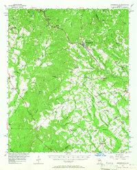
1956 Map of Jeffersonville
USGS Topo · Published 1957About this map
Jeffersonville serves as the central hub of this Georgia landscape, situated at the junction of the Macon Dublin and Savannah railroad line. The map reveals a dense network of rural life, characterized by a high concentration of country churches and family-named landmarks such as Balls Ch and Providence Churches. In the west, the Ocmulgee River forms a significant boundary, winding past settlements like Cary and the rail-oriented Bullard.
Find a feature on this map
78 named features on this map. Tap any name to fly to it.
Don’t see what you’re looking for? This feature index may not catch every label — zoom into the map to look around manually.
Map Details
Editions of this 1956 Jeffersonville Map
2 editions found
Other maps of this area

1916 · Irwinton
USGS Topo · 1:62,500

1920 · Irwinton
USGS Topo · 1:62,500

1956 · Cochran
USGS Topo · 1:62,500

1956 · Perry
USGS Topo · 1:62,500

1956 · Gordon
USGS Topo · 1:62,500

1956 · Warner Robins
USGS Topo · 1:62,500

1956 · Macon East
USGS Topo · 1:24,000

1956 · Macon
USGS Topo · 1:62,500

1957 · Macon
USGS Topo · 1:250,000

1958 · Macon
USGS Topo · 1:250,000