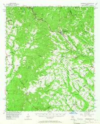
1956 Map of Jeffersonville
USGS Topo · Published 1966About this map
The Jeffersonville region in central Georgia is defined by a dense network of rural communities and small-town junctions in the mid-1950s. The seat of Twiggs County is positioned along a primary corridor leading toward Savannah, flanked by numerous family-named landmarks and rural institutions that suggest a landscape of established family farms. Dozens of small churches and schools, such as New Mt Zion Ch, Mt Zion Sch, and Faulks Chapel, serve as the focal points for these unincorporated settlements. To the south, the Ocmulgee River cuts through the terrain, fed by a complex system of creeks including Turkey Creek and Richland Creek. The map documents the intricate road and rail connections that linked towns like Danville and Tarversville to the larger regional economy, capturing the era just before the expansion of the modern interstate system.
Find a feature on this map
84 named features on this map. Tap any name to fly to it.
Don’t see what you’re looking for? This feature index may not catch every label — zoom into the map to look around manually.
Map Details
Editions of this 1956 Jeffersonville Map
2 editions found
Other maps of this area

1916 · Irwinton
USGS Topo · 1:62,500

1920 · Irwinton
USGS Topo · 1:62,500

1956 · Cochran
USGS Topo · 1:62,500

1956 · Perry
USGS Topo · 1:62,500

1956 · Gordon
USGS Topo · 1:62,500

1956 · Warner Robins
USGS Topo · 1:62,500

1956 · Jeffersonville
USGS Topo · 1:62,500

1956 · Macon East
USGS Topo · 1:24,000

1956 · Macon
USGS Topo · 1:62,500

1957 · Macon
USGS Topo · 1:250,000