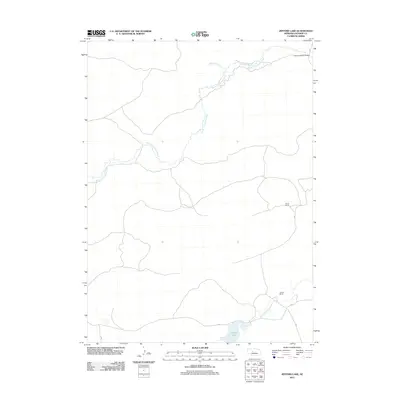
2011 Map of Jefford Lake
USGS Topo · Published 2011About this map
The North Fork Dismal River and South Fork Dismal River define the hydrography of this section of Hooker County, where the Sandhills landscape is marked by remote cattle operations and small water bodies. The terrain is characterized by a sparse network of ranch roads connecting significant local landmarks such as Jefford Lake in the southern portion and the Running Water Bridge at the northeastern corner. Isolated outposts of the regional ranching economy are represented by the Gragg Ranch and J Tucker Ranch, reflecting the enduring land-use patterns of central Nebraska. This 2011 survey records a landscape where water sources like Bobtail Creek are the primary drivers of settlement and infrastructure in a region defined by its sprawling prairie reaches and natural drainage basins.
Find a feature on this map
7 named features on this map. Tap any name to fly to it.
Don’t see what you’re looking for? This feature index may not catch every label — zoom into the map to look around manually.
Map Details
Editions of this 2011 Jefford Lake Map
This is the sole edition of this map. No revisions or reprints were ever made.
Other maps of this area

1947 · Dismal River Ranch
USGS Topo · 1:62,500

1948 · Carr Lake
USGS Topo · 1:62,500

1949 · Dismal River Ranch
USGS Topo · 1:62,500

1949 · Flats
USGS Topo · 1:62,500

1949 · Wright Valley
USGS Topo · 1:62,500

1950 · Flats
USGS Topo · 1:62,500

1950 · Carr Lake
USGS Topo · 1:62,500

1951 · Wright Valley
USGS Topo · 1:62,500

1954 · North Platte
USGS Topo · 1:250,000

1956 · North Platte
USGS Topo · 1:250,000