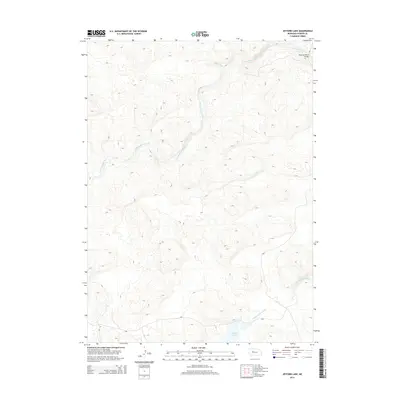
2014 Map of Jefford Lake
USGS Topo · Published 2014About this map
The Nebraska Sandhills dominate this landscape in Hooker County, where the hydrology of the Dismal River system takes center stage. The N Fork Dismal River meanders through the northern section, joined by Bobtail Cr, while the S Fork Dismal River flows across the southern reaches. This 2014 survey reveals the remote character of the region, anchored by Jefford Lake near the southeastern corner. A significant point of transit is noted at the Running Water Bridge, reflecting the sparse infrastructure necessary for navigating these dunes. The topographic detail captures the intricate relief of the sandy terrain, illustrating the natural isolation of this portion of the Great Plains where water remains the primary landmark.
Find a feature on this map
5 named features on this map. Tap any name to fly to it.
Don’t see what you’re looking for? This feature index may not catch every label — zoom into the map to look around manually.
Map Details
Editions of this 2014 Jefford Lake Map
This is the sole edition of this map. No revisions or reprints were ever made.
Other maps of this area

1947 · Dismal River Ranch
USGS Topo · 1:62,500

1948 · Carr Lake
USGS Topo · 1:62,500

1949 · Dismal River Ranch
USGS Topo · 1:62,500

1949 · Flats
USGS Topo · 1:62,500

1949 · Wright Valley
USGS Topo · 1:62,500

1950 · Flats
USGS Topo · 1:62,500

1950 · Carr Lake
USGS Topo · 1:62,500

1951 · Wright Valley
USGS Topo · 1:62,500

1954 · North Platte
USGS Topo · 1:250,000

1956 · North Platte
USGS Topo · 1:250,000