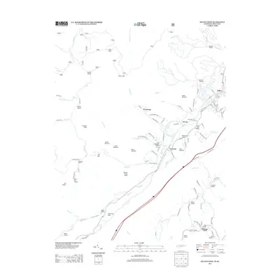
2013 Map of Jellico West
USGS Topo · Published 2013About this map
Indian Mountain and Jellico Mountain anchor the high elevations of this Tennessee-Kentucky borderland, where the terrain is deeply etched by coal-country history. The landscape is defined by its hollows and ridges, with named gaps and points such as Ellison Gap and Hells Point Ridge providing the only passage through the steep topography. Small settlements like Wooldridge, Oswego, and Newcomb are situated along the valley floors, often following the winding paths of Indian Creek and Crooked Creek.
Find a feature on this map
111 named features on this map. Tap any name to fly to it.
Don’t see what you’re looking for? This feature index may not catch every label — zoom into the map to look around manually.
Map Details
Editions of this 2013 Jellico West Map
This is the sole edition of this map. No revisions or reprints were ever made.
Other maps of this area

1890 · Williamsburg
USGS Topo · 1:125,000

1893 · Briceville
USGS Topo · 1:125,000

1894 · Williamsburg
USGS Topo · 1:125,000

1895 · Briceville
USGS Topo · 1:125,000

1896 · Briceville
USGS Topo · 1:125,000

1936 · Ivydell
USGS Topo · 1:24,000

1936 · Pioneer
USGS Topo · 1:24,000

1936 · La Follette
USGS Topo · 1:48,000
1936 · La Follette
USGS Topo · 1:24,000
1946 · Ivydell
USGS Topo · 1:24,000