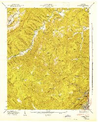
1946 Map of Ivydell
USGS Topo · Published 1947About this map
Pine Mountain and Walden Ridge dominate this Tennessee landscape, where mid-century life was concentrated along the narrow hollows and creek beds. The drainage of Stinking Creek and Hickory Creek dictates the placement of early infrastructure, including the Southern Ry corridor passing through Elk Valley. This survey provides a vital record for genealogists, as it identifies numerous family-named landmarks and resting places such as Hatfield Cem, Baird Cem, and Henry Ayers Cem. The social fabric of the era is evident in the distribution of rural institutions like Broyles Chapel, Jennings Sch, and the New Liberty Ch. On higher ground, the Walnut Mtn Firetower stands over a terrain defined by steep gaps like Cave Gap and Hogjaw Gap, while La Follette Reservoir sits just north of the city limits of La Follette.
Find a feature on this map
88 named features on this map. Tap any name to fly to it.
Don’t see what you’re looking for? This feature index may not catch every label — zoom into the map to look around manually.
Map Details
Editions of this 1946 Ivydell Map
This is the sole edition of this map. No revisions or reprints were ever made.
Other maps of this area

1890 · Williamsburg
USGS Topo · 1:125,000

1893 · Briceville
USGS Topo · 1:125,000

1894 · Williamsburg
USGS Topo · 1:125,000

1895 · Briceville
USGS Topo · 1:125,000

1896 · Briceville
USGS Topo · 1:125,000

1936 · Ivydell
USGS Topo · 1:24,000

1936 · Block
USGS Topo · 1:24,000

1936 · Jacksboro
USGS Topo · 1:24,000

1936 · Pioneer
USGS Topo · 1:24,000

1936 · La Follette
USGS Topo · 1:48,000