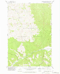
1977 Map of Jennings Camp Creek
USGS Topo · Published 1978About this map
The Bitterroot National Forest dominates this mountain landscape in southwestern Montana, showcasing the complex drainage systems of the East Fork Bitterroot River. Published in 1978 from 1970s fieldwork, the map details a network of named waterways including Jennings Camp Creek, Rye Creek, and Martin Creek that carve through high-elevation terrain punctuated by Blue Mountain. The southern edge of the map transitions into the Anaconda Pintlar Wilderness, emphasizing the primitive character of the region during this era.
Find a feature on this map
29 named features on this map. Tap any name to fly to it.
Don’t see what you’re looking for? This feature index may not catch every label — zoom into the map to look around manually.
Map Details
Editions of this 1977 Jennings Camp Creek Map
This is the sole edition of this map. No revisions or reprints were ever made.
Other maps of this area

1909 · Sapphire
USGS Topo · 1:125,000

1947 · Butte
USGS Topo · 1:250,000

1955 · Dillon
USGS Topo · 1:250,000

1957 · Dillon
USGS Topo · 1:250,000

1958 · Butte
USGS Topo · 1:250,000

1958 · Dillon
USGS Topo · 1:250,000

1960 · Butte
USGS Topo · 1:250,000

1962 · Butte
USGS Topo · 1:250,000

1962 · Dillon
USGS Topo · 1:250,000

1965 · Dillon
USGS Topo · 1:250,000