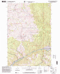
1998 Map of Jennings Camp Creek
USGS Topo · Published 2002About this map
The East Fork Bitterroot River carves through this mountainous landscape in the southern Bitterroot Valley, serving as a primary corridor for travel and recreation. As mapped in the late 1990s, the area is defined by the extensive Bitterroot National Forest and the protected terrain of the Anaconda Pintler Wilderness along its eastern edge. The topography is intricately detailed, showing the numerous drainages that feed the river, including Martin Creek, Cameron Creek, and Jennings Creek.
Find a feature on this map
19 named features on this map. Tap any name to fly to it.
Don’t see what you’re looking for? This feature index may not catch every label — zoom into the map to look around manually.
Map Details
Editions of this 1998 Jennings Camp Creek Map
This is the sole edition of this map. No revisions or reprints were ever made.
Other maps of this area

1909 · Sapphire
USGS Topo · 1:125,000

1947 · Butte
USGS Topo · 1:250,000

1955 · Dillon
USGS Topo · 1:250,000

1957 · Dillon
USGS Topo · 1:250,000

1958 · Butte
USGS Topo · 1:250,000

1958 · Dillon
USGS Topo · 1:250,000

1960 · Butte
USGS Topo · 1:250,000

1962 · Butte
USGS Topo · 1:250,000

1962 · Dillon
USGS Topo · 1:250,000

1965 · Dillon
USGS Topo · 1:250,000