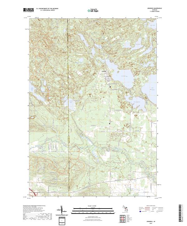
2023 Map of Jennings
USGS Topo · Published 2023About this map
Jennings serves as the primary settlement on this landscape, positioned north of the winding Clam River and west of the large expanse of Lake Missaukee. The town's layout is centered around local roads such as W Walnut St and Elm St, reflecting its historical development near the lakeshores. Traces of previous industry and transport are visible through the Old RR Grade, which cuts through the central terrain between Round Lake and Shallow Lake, marking the path of former timber or freight movements.
Find a feature on this map
63 named features on this map. Tap any name to fly to it.
Don’t see what you’re looking for? This feature index may not catch every label — zoom into the map to look around manually.
Map Details
Editions of this 2023 Jennings Map
This is the sole edition of this map. No revisions or reprints were ever made.
Other maps of this area

1954 · Traverse City
USGS Topo · 1:250,000

1956 · Cadillac North
USGS Topo · 1:62,500

1956 · Lake City
USGS Topo · 1:62,500

1957 · Cadillac South
USGS Topo · 1:62,500

1957 · Marion
USGS Topo · 1:62,500

1958 · Traverse City
USGS Topo · 1:250,000

1983 · Cadillac
USGS Topo · 1:100,000

1983 · Lake City
USGS Topo · 1:25,000

1983 · Manton
USGS Topo · 1:25,000

1983 · Cadillac North
USGS Topo · 1:24,000