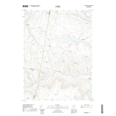
2019 Map of Jenningsville
USGS Topo · Published 2019About this map
Jenningsville and the surrounding rural valleys of Wyoming and Bradford counties are defined by the winding course of the Susquehanna River and the steep, complex drainage systems of Mehoopany Creek. This landscape is marked by high ridges like Bartlett Mtn and Shingle Ridge, where numerous small runs and brooks, such as Rock Cabin Run and Miller Brook, carve deep hollows into the terrain. The settlement pattern remains largely dispersed along township roads and creek beds, with small communities like Lovelton and Stowell serving as historic focal points for local commerce and residency. For those researching local lineages, the Pearson-Robinson Cem near the riverbank offers a specific point of interest. The network of mountain roads, including Old Highway Ln and Farr Hollow Rd, follows the natural contours of the land, illustrating how geography has dictated travel and development in this corner of Pennsylvania for generations.
Find a feature on this map
87 named features on this map. Tap any name to fly to it.
Don’t see what you’re looking for? This feature index may not catch every label — zoom into the map to look around manually.
Map Details
Editions of this 2019 Jenningsville Map
This is the sole edition of this map. No revisions or reprints were ever made.
Other maps of this area

1891 · Harveys Lake
USGS Topo · 1:62,500

1893 · Harvey Lake
USGS Topo · 1:62,500

1934 · Laporte
USGS Topo · 1:62,500

1943 · Monroeton
USGS Topo · 1:62,500

1945 · Meshoppen
USGS Topo · 1:62,500

1945 · Auburn Center
USGS Topo · 1:24,000

1945 · Jenningsville
USGS Topo · 1:24,000

1945 · Meshoppen
USGS Topo · 1:24,000

1945 · Laceyville
USGS Topo · 1:24,000

1946 · Dutch Mtn
USGS Topo · 1:24,000
Featured Places
- Wilmot Township, PA
- Colley Township, PA
- Forkston Township, PA
- North Branch Township, PA
- Hollenback, Wilmot Township