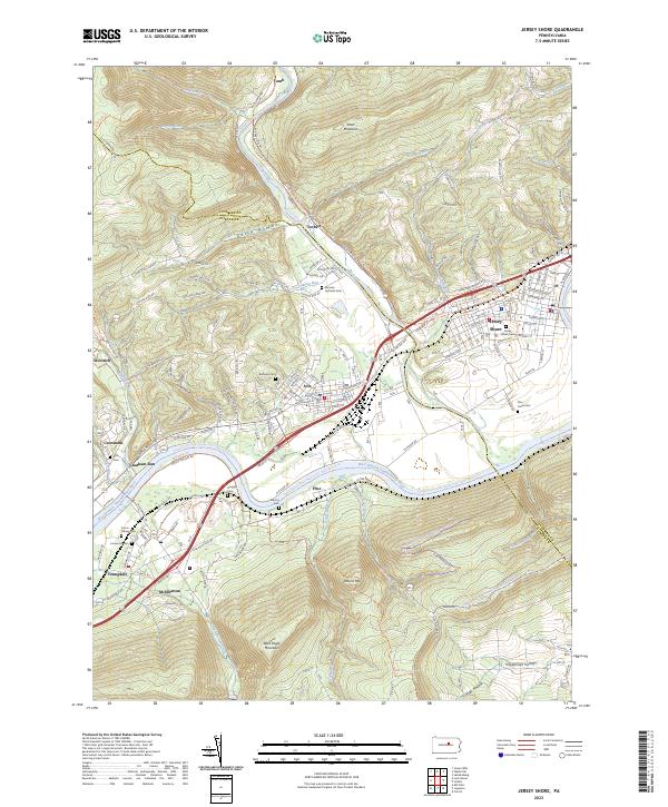
2023 Map of Jersey Shore
USGS Topo · Published 2023About this map
The West Branch Susquehanna River and Pine Creek define the geography of this corridor, where the river cuts through the gap between Bald Eagle Mountain and the rising slopes of Short Mountain. The settlement of Jersey Shore occupies the river's northern bank just east of the Pine Creek confluence, while smaller communities like Avis, McElhattan, and Youngdale follow the valley floor. The map is a vital resource for genealogists, documenting numerous small burial grounds including Garman Lutheran Cem, Quiggle Cem, and the Union-Throne Cem. These sites, along with family-named features like Gamble Run and Aughanbaugh Run, reflect the deep-rooted local history of this Lycoming and Clinton county border region. Modern recreational use is visible through the Mid State Trail and Tiadaghton State Forest Snowmobile Trails, which traverse the high ground near Round Top.
Find a feature on this map
47 named features on this map. Tap any name to fly to it.
Don’t see what you’re looking for? This feature index may not catch every label — zoom into the map to look around manually.
Map Details
Editions of this 2023 Jersey Shore Map
This is the sole edition of this map. No revisions or reprints were ever made.
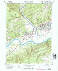
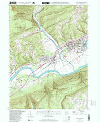
Historical Maps of Jersey Shore Through Time
3 maps found