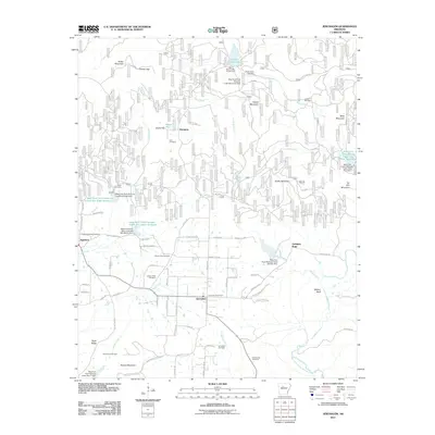
2011 Map of Jerusalem
USGS Topo · Published 2011About this map
Jerusalem serves as the central hub of this Conway County landscape, situated near the headwaters of Cedar Creek. The settlement pattern reflects a deeply rooted community, evidenced by the high density of family and community burial grounds including Sulphur Springs Cemetery, Cato Cemetery, and Mount Zion Cemetery. To the south, the Jerusalem Gas Field indicates the region's industrial connection to natural resources, while the northern terrain is defined by water management and recreation at Brock Creek Lake.
Find a feature on this map
461 named features on this map. Tap any name to fly to it.
Don’t see what you’re looking for? This feature index may not catch every label — zoom into the map to look around manually.
Map Details
Editions of this 2011 Jerusalem Map
This is the sole edition of this map. No revisions or reprints were ever made.
Other maps of this area

1879 · Washington
USGS Topo · 1:62,500

1887 · Smyrna
USGS Topo · 1:62,500

1889 · Marshall #3
USGS Topo · 1:62,500

1892 · Marshall
USGS Topo · 1:125,000

1892 · Morrillton
USGS Topo · 1:125,000

1894 · Morrillton
USGS Topo · 1:125,000

1894 · Marshall
USGS Topo · 1:125,000

1901 · Marshall
USGS Topo · 1:125,000

1940 · Smyrna
USGS Topo · 1:62,500
1943 · Smyrna
USGS Topo · 1:62,500