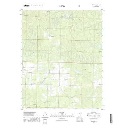
2020 Map of Jerusalem
USGS Topo · Published 2020About this map
Jerusalem sits at the heart of this landscape, positioned along Jerusalem RD where the hills of the Ozark National Forest meet the rolling countryside of Conway County. The 2020 terrain is defined by a dense network of family-named cemeteries and rural roads that trace the complex topography of the Arkansas Ozarks. Notable burial grounds like Cato Cem near Stumptoe and Sulphur Springs Cem near Appleton serve as vital markers for local genealogy.
Find a feature on this map
89 named features on this map. Tap any name to fly to it.
Don’t see what you’re looking for? This feature index may not catch every label — zoom into the map to look around manually.
Map Details
Editions of this 2020 Jerusalem Map
This is the sole edition of this map. No revisions or reprints were ever made.
Other maps of this area

1879 · Washington
USGS Topo · 1:62,500

1887 · Smyrna
USGS Topo · 1:62,500

1889 · Marshall #3
USGS Topo · 1:62,500

1892 · Marshall
USGS Topo · 1:125,000

1892 · Morrillton
USGS Topo · 1:125,000

1894 · Morrillton
USGS Topo · 1:125,000

1894 · Marshall
USGS Topo · 1:125,000

1901 · Marshall
USGS Topo · 1:125,000

1940 · Smyrna
USGS Topo · 1:62,500
1943 · Smyrna
USGS Topo · 1:62,500