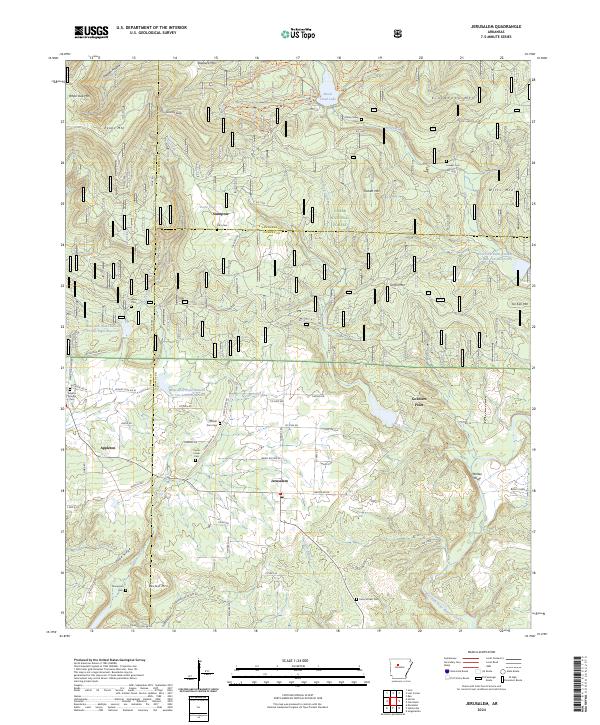
2024 Map of Jerusalem
USGS Topo · Published 2024About this map
Jerusalem serves as a central hub in this section of the Ozark National Forest, where the intersection of Jerusalem Rd and Co Hwy 906 anchors a landscape defined by sharp ridges and deep creek valleys. The area is marked by numerous family and community landmarks, including Cato Cem near Stumptoe and Mount Zion Cem to the west. The terrain is notably defined by high points like Kincannon Mtn and Stoebuck Mtn, which overlook the winding paths of Brock Creek and the West Fork Point Remove Creek. A series of water management sites, such as West Fork Point Remove Cr Site Seven Reservoir, illustrates modern hydrological engineering within the traditional forest boundaries. To the southwest, the settlement of Appleton sits near Cedar Creek, while numerous smaller crossings like Cow Ford suggest the enduring importance of local water access points for travelers and residents alike.
Find a feature on this map
74 named features on this map. Tap any name to fly to it.
Don’t see what you’re looking for? This feature index may not catch every label — zoom into the map to look around manually.
Map Details
Editions of this 2024 Jerusalem Map
This is the sole edition of this map. No revisions or reprints were ever made.
Other maps of this area

1879 · Washington
USGS Topo · 1:62,500

1887 · Smyrna
USGS Topo · 1:62,500

1889 · Marshall #3
USGS Topo · 1:62,500

1892 · Marshall
USGS Topo · 1:125,000

1892 · Morrillton
USGS Topo · 1:125,000

1894 · Morrillton
USGS Topo · 1:125,000

1894 · Marshall
USGS Topo · 1:125,000

1901 · Marshall
USGS Topo · 1:125,000

1940 · Smyrna
USGS Topo · 1:62,500
1943 · Smyrna
USGS Topo · 1:62,500