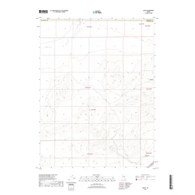
2018 Map of Jessup
USGS Topo · Published 2018About this map
Trinity Range dominate the center of this landscape, rising above the arid basins of western Nevada. This 2018 survey documents the vicinity of Jessup, a location with deep roots in regional mining history. The terrain is defined by dry drainage systems such as Sage Hen Wash, which carves through the northern hills toward the Copper Valley. To the southeast, the map edges into the storied Fortymile Desert, a segment of the Emigrant Trail historically feared for its lack of water. Modern infrastructure is represented primarily by Alt 95, providing transit through this sparsely settled portion of Churchill County. The map also delineates the high-desert border with Pershing County, following the township lines that grid the open range.
Find a feature on this map
14 named features on this map. Tap any name to fly to it.
Don’t see what you’re looking for? This feature index may not catch every label — zoom into the map to look around manually.
Map Details
Editions of this 2018 Jessup Map
This is the sole edition of this map. No revisions or reprints were ever made.
Other maps of this area

1886 · Granite Range
USGS Topo · 1:250,000

1890 · Wadsworth
USGS Topo · 1:125,000

1892 · Wadsworth
USGS Topo · 1:125,000

1894 · Granite Range
USGS Topo · 1:250,000

1894 · Wadsworth
USGS Topo · 1:125,000

1908 · Carson Sink
USGS Topo · 1:250,000

1910 · Carson Sink
USGS Topo · 1:250,000

1931 · Lovelock
USGS Topo · 1:250,000

1935 · Lovelock
USGS Topo · 1:250,000

1951 · Desert Peak
USGS Topo · 1:62,500