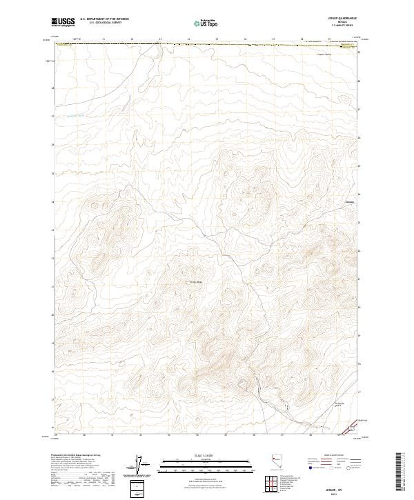
2021 Map of Jessup
USGS Topo · Published 2021About this map
Trinity Range dominates the central landscape of this West-Central Nevada survey, providing a stark topographical contrast to the surrounding desert flats. The area is defined by the high-elevation ridges that divide Copper Valley to the north from the expansive Fortymile Desert to the south. Historically significant for its mining associations, the small settlement of Jessup sits on the eastern edge of the mountains, marking a site where early 20th-century prospectors once sought gold and silver. The lack of permanent water is evident in features like Sage Hen Wash, which only carries seasonal runoff through the arid terrain. The map captures the intersection of the Churchill and Pershing county lines, showing how modern infrastructure like Alt 95 skirts the base of the mountains to connect this remote high-desert region.
Find a feature on this map
14 named features on this map. Tap any name to fly to it.
Don’t see what you’re looking for? This feature index may not catch every label — zoom into the map to look around manually.
Map Details
Editions of this 2021 Jessup Map
This is the sole edition of this map. No revisions or reprints were ever made.
Other maps of this area

1886 · Granite Range
USGS Topo · 1:250,000

1890 · Wadsworth
USGS Topo · 1:125,000

1892 · Wadsworth
USGS Topo · 1:125,000

1894 · Granite Range
USGS Topo · 1:250,000

1894 · Wadsworth
USGS Topo · 1:125,000

1908 · Carson Sink
USGS Topo · 1:250,000

1910 · Carson Sink
USGS Topo · 1:250,000

1931 · Lovelock
USGS Topo · 1:250,000

1935 · Lovelock
USGS Topo · 1:250,000

1951 · Desert Peak
USGS Topo · 1:62,500