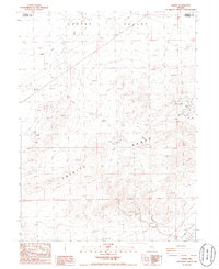
1986 Map of Jessup
USGS Topo · Published 1986About this map
Central Jessup District Mining Area dominates this section of the Trinity Range in the mid-1980s, revealing a landscape defined by mineral extraction and desert transit. The map centers on the Jessup (Site) and numerous prospects, documenting the physical footprint of the Gold Ore Hap 60 Claims 60-33 and other unnamed mining operations. This industrial activity is framed by the natural drainages of Copper Valley to the north and the arid expanse of the Fortymile Desert to the southeast. Movement through this remote terrain is illustrated by a network of 4wd tracks, utility corridors like the Trans Line and Pipeline, and natural features such as Wash and Hen Sage. The border between Pershing Co and Churchill Co bisects the northern reaches, marking a political boundary across the high desert topography.
Find a feature on this map
15 named features on this map. Tap any name to fly to it.
Don’t see what you’re looking for? This feature index may not catch every label — zoom into the map to look around manually.
Map Details
Editions of this 1986 Jessup Map
This is the sole edition of this map. No revisions or reprints were ever made.
Other maps of this area

1886 · Granite Range
USGS Topo · 1:250,000

1890 · Wadsworth
USGS Topo · 1:125,000

1892 · Wadsworth
USGS Topo · 1:125,000

1894 · Granite Range
USGS Topo · 1:250,000

1894 · Wadsworth
USGS Topo · 1:125,000

1908 · Carson Sink
USGS Topo · 1:250,000

1910 · Carson Sink
USGS Topo · 1:250,000

1931 · Lovelock
USGS Topo · 1:250,000

1935 · Lovelock
USGS Topo · 1:250,000

1951 · Desert Peak
USGS Topo · 1:62,500