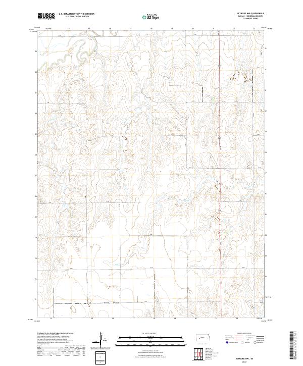
2022 Map of Jetmore NW
USGS Topo · Published 2022About this map
Pawnee River defines the northern reaches of this rural Kansas landscape, where the high plains terrain is carved by intermittent drainage systems. The hydrology is dominated by the winding course of the river and its southern tributaries, including Cottonwood Cr and Dry Cr. This area of Hodgeman County is organized by a strict cardinal grid of rural roads, such as 218 RD and S RD, which delineate the Public Land Survey System sections. These survey lines, including boundaries for t21s r24w and t22s r23w, reflect the late 19th-century settlement patterns that divided the shortgrass prairie into agricultural parcels. The map provides a clear view of the topographic contours and watercourses that have dictated land use in this sparsely populated region for generations.
Find a feature on this map
21 named features on this map. Tap any name to fly to it.
Don’t see what you’re looking for? This feature index may not catch every label — zoom into the map to look around manually.
Map Details
Editions of this 2022 Jetmore NW Map
This is the sole edition of this map. No revisions or reprints were ever made.
Other maps of this area

1892 · Ness
USGS Topo · 1:125,000

1894 · Ness
USGS Topo · 1:125,000

1955 · Great Bend
USGS Topo · 1:250,000

1955 · Scott City
USGS Topo · 1:250,000

1957 · Great Bend
USGS Topo · 1:250,000

1958 · Great Bend
USGS Topo · 1:250,000

1958 · Scott City
USGS Topo · 1:250,000

1969 · Jetmore
USGS Topo · 1:24,000

1970 · Jetmore SE
USGS Topo · 1:24,000

1970 · Jetmore NE
USGS Topo · 1:24,000