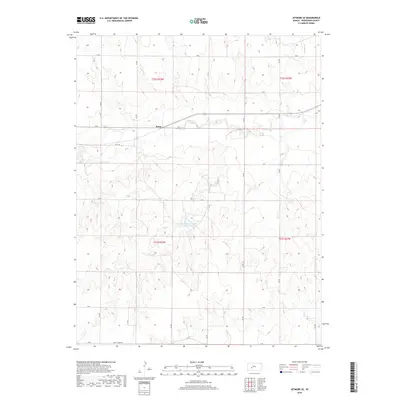
2018 Map of Jetmore SE
USGS Topo · Published 2018About this map
The tiny settlement of Bosse anchors this portion of Hodgeman County, situated along the path of 156 as it parallels the winding course of Buckner Cr. This 2018 survey reveals a landscape defined by a grid-like network of rural roads such as M RD and L RD, characteristic of the High Plains' agricultural structure. A significant landmark in the central portion of the sheet is Hodgeman County State Lake, which is fed by the seasonal drainage of Rock Cr. The topography reflects a series of low ridges and valleys between these watercourses, illustrating the transition from open range to localized water management and recreation. Toward the southern edge, Golf Course Rd hints at modern community development amidst the traditional township and range divisions of t23s r23w and t23s r22w.
Find a feature on this map
18 named features on this map. Tap any name to fly to it.
Don’t see what you’re looking for? This feature index may not catch every label — zoom into the map to look around manually.
Map Details
Editions of this 2018 Jetmore SE Map
This is the sole edition of this map. No revisions or reprints were ever made.
Other maps of this area

1892 · Ness
USGS Topo · 1:125,000

1892 · Spearville
USGS Topo · 1:125,000

1894 · Spearville
USGS Topo · 1:125,000

1894 · Ness
USGS Topo · 1:125,000

1955 · Great Bend
USGS Topo · 1:250,000

1955 · Pratt
USGS Topo · 1:250,000

1957 · Great Bend
USGS Topo · 1:250,000

1958 · Great Bend
USGS Topo · 1:250,000

1959 · Pratt
USGS Topo · 1:250,000

1969 · Jetmore
USGS Topo · 1:24,000