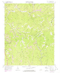
1968 Map of Jewell Ridge
USGS Topo · Published 1978About this map
Jewell Ridge and the surrounding coalfields of the Buchanan Co Tazewell Co line are defined here by a dense network of strip mines and extraction infrastructure. The landscape is a complex system of ridges like Whiteplace Ridge and Sugar Cove Mountain, where the Norfolk and Western railroad tracks follow the winding paths of Dismal Creek and its tributaries to serve remote settlements. This 1960s survey, updated in the late 1970s, captures the industrial footprint of the era, from the conveyor systems at Coaldan to the numerous strip mines dotting the slopes of Sandy Ridge. Beyond the industry, the map documents the community life of the hollows, preserving the locations of local landmarks such as Jewell Camp Chapel, Stevenson Smith Ch, and the Jewell Valley Sch. Small family and community plots including Sawyer Cem and Boyd Cem are scattered across the terrain, offering vital data for genealogical research in this part of Appalachia.
Find a feature on this map
74 named features on this map. Tap any name to fly to it.
Don’t see what you’re looking for? This feature index may not catch every label — zoom into the map to look around manually.
Map Details
Editions of this 1968 Jewell Ridge Map
2 editions found
Other maps of this area

1891 · Tazewell
USGS Topo · 1:125,000

1895 · Tazewell
USGS Topo · 1:125,000

1897 · Tazewell
USGS Topo · 1:125,000

1910 · Iaeger
USGS Topo · 1:48,000

1912 · Pounding Mill
USGS Topo · 1:62,500

1912 · Iaeger
USGS Topo · 1:62,500

1912 · Welch
USGS Topo · 1:62,500

1914 · Iaeger
USGS Topo · 1:48,000

1915 · Richlands
USGS Topo · 1:48,000

1916 · Pounding Mill
USGS Topo · 1:62,500