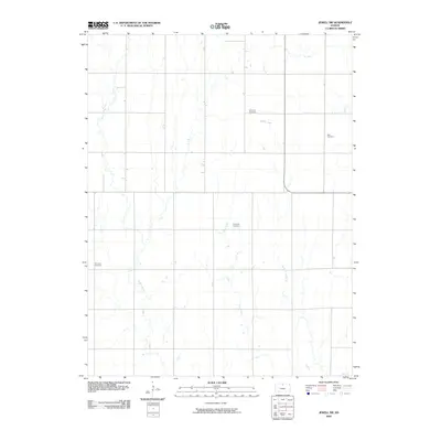
2009 Map of Jewell SW
USGS Topo · Published 2009About this map
Mulberry Creek and its various tributaries, including Dog Creek and Plum Creek, carve a branching drainage pattern across this northern Kansas landscape. This 2009 survey by the U.S. Geological Survey reveals a rural section of Mitchell County defined by a precise section-line road grid and scattered local landmarks. Genealogy researchers will find several well-defined burial grounds positioned along these upland ridges and creek bends, including Fairview Cemetery in the north and west, Glendale Cemetery near the center, and Star Cemetery to the east. The terrain is marked by the subtle shift from the banks of Browns Creek to the higher plains, illustrating the agricultural layout and sparse settlement typical of the region during the early twenty-first century.
Find a feature on this map
8 named features on this map. Tap any name to fly to it.
Don’t see what you’re looking for? This feature index may not catch every label — zoom into the map to look around manually.
Map Details
Editions of this 2009 Jewell SW Map
This is the sole edition of this map. No revisions or reprints were ever made.
Other maps of this area

1894 · Mankato
USGS Topo · 1:125,000

1894 · Beloit
USGS Topo · 1:125,000

1953 · Solomon Rapids
USGS Topo · 1:24,000

1953 · Glen Elder South
USGS Topo · 1:24,000

1953 · Beloit
USGS Topo · 1:24,000

1955 · Beloit
USGS Topo · 1:250,000

1959 · Beloit
USGS Topo · 1:250,000

1962 · Jewell SE
USGS Topo · 1:24,000

1962 · Glen Elder North
USGS Topo · 1:24,000

1962 · Jewell SW
USGS Topo · 1:24,000