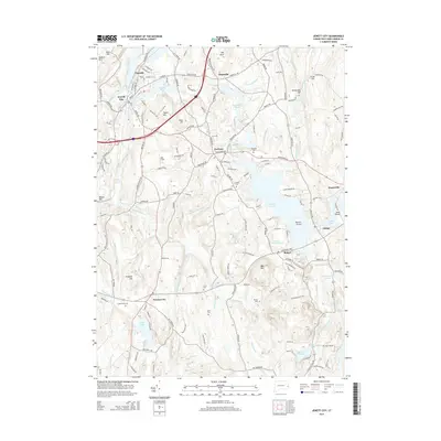
2015 Map of Jewett City
USGS Topo · Published 2015About this map
The Quinebaug River and Pachaug River converge at Jewett City, anchoring a landscape shaped by water power and colonial-era settlement. This 2015 update details a corridor of historically significant villages, including Clayville, Hopeville, and Pachaug, where mill ponds like Ashland Pond and Grist Mill Pond speak to the region's industrial heritage. The survey is particularly valuable for genealogical research, locating numerous family and community burial grounds such as Crary Cem, Leonard Cem, and Fobes-Amos Cem scattered across the uplands. From the heights of Bay Mtn to the shoreline of Amos Lake, the map documents the dense network of local roads and water bodies, including Pachaug Pond and the winding Ashwillet Brook, that have defined this corner of New London County for centuries.
Find a feature on this map
165 named features on this map. Tap any name to fly to it.
Don’t see what you’re looking for? This feature index may not catch every label — zoom into the map to look around manually.
Map Details
Editions of this 2015 Jewett City Map
This is the sole edition of this map. No revisions or reprints were ever made.
Other maps of this area

1889 · Stonington
USGS Topo · 1:62,500

1889 · Moosup
USGS Topo · 1:62,500

1892 · New London
USGS Topo · 1:62,500

1892 · Norwich
USGS Topo · 1:62,500

1893 · Moosup
USGS Topo · 1:62,500

1893 · Stonington
USGS Topo · 1:62,500

1893 · New London
USGS Topo · 1:62,500

1920 · Moosup
USGS Topo · 1:62,500

1921 · New London
USGS Topo · 1:62,500

1921 · Stonington
USGS Topo · 1:62,500